Derbyshire

Derbyshire, England — the ceremonial county of the Peak District

Location Profile
Type Ceremonial county and non-metropolitan county
Region East Midlands, England
Country England, United Kingdom
Area 2,625 km² (non-metropolitan; ceremonial county larger)
Population 794,636 (2021 census, non-metropolitan); c. 1.07 million (ceremonial county)
County Town Matlock (since 1955)
Largest Settlement Derby (unitary authority)
Highest Point Kinder Scout, 636 m (2,087 ft)
Major Rivers Derwent, Wye, Dove, Trent
Notable Features Peak District National Park (1951, the UK's first); Derwent Valley Mills World Heritage Site
First Appearance Cambion, Chapter One: Quiet

Derbyshire

Ceremonial county in the East Midlands of England.


Overview

Derbyshire is a ceremonial county in the East Midlands of England, on the southern edge of the Pennine uplands. It is bordered by Greater Manchester to the north-west, West Yorkshire and South Yorkshire to the north and north-east, Nottinghamshire to the east, Leicestershire to the south-east, and Staffordshire and Cheshire to the west. Its non-metropolitan population, recorded at 794,636 in the 2021 census, sits across thirty towns of between ten and a hundred thousand inhabitants and a substantial rural population in the Peak District uplands; including the city of Derby, an administratively independent unitary authority, the ceremonial county totals around 1.07 million.

The county is dominated, in geography and in character, by the Peak District — the moorland and limestone-plateau country occupying the northern half of the county, designated in 1951 as the United Kingdom's first National Park. South of the Park, the country falls in stages through the lower Derwent valley to the lowland farmland around Derby and the floodplain of the Trent. The county is the principal geographical setting of the Book of Thoth Saga, in which the village of Hope's End — fictional, but located within Derbyshire's real geography — sits at its centre.


Geography & Atmosphere

Derbyshire is a county of clear geological and topographic divides. The northern half, occupying most of the National Park, is divided between the Dark Peak — high gritstone moorland of millstone grit, blanket peat and heather, dominated by the elevated plateau of Kinder Scout (636 m / 2,087 ft, the county top) and the surrounding moors of Bleaklow, Howden, Derwent, and Stanage Edge — and the White Peak, a Carboniferous limestone plateau cut by the steep dales of the Wye, the Derwent, the Lathkill and the Dove. The two landscapes meet in a clear visual line: the dark, peat-stained slopes of the gritstone country giving way southward to the pale stone walls and bright green pastures of the limestone dales.

The county's rivers run roughly north to south. The Derwent, at sixty-six miles the longest river in Derbyshire, rises on Bleaklow in the Dark Peak, gathers the waters of the Ladybower, Howden and Derwent reservoirs, then runs south through Hathersage, Bakewell, Matlock Bath, Belper and the city of Derby to join the Trent below the southern edge of the county. The Wye, the Dove and the Amber are its principal tributaries. The Trent itself forms the county's southern boundary; the lowest point in Derbyshire is Trent Meadows at twenty-seven metres above sea level, where the river leaves the county for Nottinghamshire.

South and east of the Peak, the country is gentler. The Derbyshire coalfield, around Chesterfield and the eastern fringe of the county, was through the nineteenth and twentieth centuries one of the principal coalfields of the East Midlands; its terraced colliery villages, Miners' Welfare clubs and reclaimed spoil heaps are still part of the visible landscape. The South Derbyshire farmland, in the Trent valley, is largely lowland mixed farming. In 2003 the Ordnance Survey identified Church Flatts Farm at Coton in the Elms, on Derbyshire's southern edge, as the geographical point in Great Britain furthest from the sea.

History

Human occupation of the area now called Derbyshire goes back at least to the Middle Palaeolithic, evidenced by the Acheulean hand axe found near Hopton in the southern part of the county, and to a series of late Palaeolithic and Mesolithic limestone-cave sites along the eastern edge of the Peak. Neolithic monuments of the Peak District — chambered tombs, henges (notably Arbor Low, near Youlgrave, sometimes called ‘the Stonehenge of the North’) and stone circles — survive in considerable numbers across the limestone uplands. By the Iron Age, the area was occupied by the British tribes of the Corieltauvi in the south-east and the Brigantes in the north; Mam Tor, on the boundary between the Dark Peak and the Hope Valley, is one of the most prominent Iron Age hill forts in the central Peak District.

Roman occupation of the region followed the conquest of the Brigantes in the late first century AD. Roman forts were established at Derventio (modern Derby), Navio (Brough-on-Noe in the Hope Valley), Melandra (Glossop) and at Aquae Arnemetiae (modern Buxton), which functioned as one of only two named Roman bath towns in Britain. The road network — Ryknild Street running south-west to north-east, Batham Gate from Buxton to South Yorkshire, the Long Causeway over the moors — preserved the regional pattern of Roman administration well into the medieval period. Lead mining, an industry that would shape the central Peak for the next eighteen centuries, began on a substantial scale under Roman direction.

After the Roman withdrawal in the early fifth century, the area was settled by Anglo-Saxons of the Anglian kingdom of Mercia. The Danish invasions of the late ninth century brought the river-valley settlements within the Danelaw: Derby became one of the Five Boroughs of the Danelaw, alongside Nottingham, Lincoln, Leicester and Stamford, governed under a separate body of law from the surrounding English kingdoms. Anglo-Saxon Mercia recovered the Five Boroughs under the Mercian queen-regent Lady Aethelflaed, daughter of Alfred the Great, who took Derby in July 917. The Danish presence is preserved across the county in place-names ending in -by, -thorpe and -toft, in the modern dialect, and in the persistence of Scandinavian first names through the medieval period.

The medieval county that took shape after the Norman Conquest was a patchwork of Crown estates, monastic foundations and aristocratic holdings centred on the great Cavendish, Manners and Talbot dynasties. The High Peak was a Royal Forest from the eleventh century to the eighteenth; the Cavendishes of Chatsworth, the Manners of Haddon Hall, and the Talbots of Sheffield Castle dominated county politics for much of the early modern period. Bakewell, Chesterfield and Derby all held royal market charters by the end of the thirteenth century. Derbyshire's most famous early modern resident, Bess of Hardwick (1527–1608), Countess of Shrewsbury, accumulated a remarkable property portfolio centred on Hardwick Hall and Chatsworth; through her marriage to George Talbot, sixth Earl of Shrewsbury, she became the keeper, at a number of Derbyshire houses including Chatsworth and Buxton, of the captive Mary, Queen of Scots, in the 1570s and 1580s.

The county's most distinctive contribution to history is its early role in the Industrial Revolution. Derby's Lombe Mill (1717–21) was the first water-powered silk-throwing mill in Britain and is widely regarded as the prototype of the modern factory. From the 1770s onward, the lower and central Derwent valley became the engine of the early British factory system: Sir Richard Arkwright's Cromford Mill (1771), Jedediah Strutt's mills at Belper, Masson Mills at Matlock Bath. The fifteen-mile reach of the Derwent from Matlock Bath to Derby was inscribed as the Derwent Valley Mills UNESCO World Heritage Site in 2001 in recognition of its standing as the cradle of the modern factory system. By the second half of the nineteenth century Derbyshire was also a substantial coalfield, a centre of railway engineering (at Derby from 1844), and, from 1908 onwards, the home of Rolls-Royce's aero-engine business.

The twentieth century saw the partial dismantling of the heavy-industry economy and the parallel emergence of Derbyshire as a tourist county. The Peak District, designated in 1951 as the first National Park in the United Kingdom, now receives in the order of thirteen million visitors a year. The Derbyshire coalfield closed in 1993–94 in the wake of the 1984–85 miners' strike, with consequences that continue to shape the social geography of the eastern part of the county. The county council, which had previously sat at Derby, moved its headquarters in 1955 to John Smedley's former hydropathic establishment at Matlock, where it remains; Derby itself was reorganised as an independent unitary authority in 1997.


Cultural Identity

Derbyshire's cultural identity is anchored in three things: the landscape of the Peak, the dialects of the East Midlands, and a number of distinctive customs preserved with some persistence in the county's villages.

The Derbyshire dialect, related to but distinct from the dialects of South Yorkshire, North Staffordshire and the East Midlands more broadly, retains a number of words traceable to Old English, Old Norse, and Northern Middle English that are now uncommon elsewhere. Nesh, meaning soft, sensitive to cold or weather, is perhaps the most durably surviving; mardy, sulky or fussy, is widely heard; mithered, troubled or fussed at, retains currency in older speech; the regional address-form duck, used to friend, stranger and shopkeeper alike, is so commonplace as to be effectively standard register in much of the county.

Well dressing — the practice of decorating natural springs and wells with elaborate panels of flower petals, seeds, leaves and other natural materials worked into a clay-faced board, displayed for a few days each summer in the village in question — is a custom unique to the Peak District and the immediately adjoining parts of Derbyshire and Staffordshire. Its origins are obscure, generally held to descend from a pre-Christian thanksgiving for the survival of fresh water through periods of drought or plague; the modern revival of the custom dates from the late eighteenth century, when many Peak villages re-instituted the practice on a fixed annual calendar. Tissington, near Ashbourne, is conventionally regarded as the principal well-dressing village. Buxton, Tideswell, Eyam and twenty-odd other villages all hold their own.

Other distinctive Derbyshire institutions include the plague village of Eyam, whose inhabitants quarantined themselves voluntarily during the bubonic plague outbreak of 1665–66 to prevent its spread to the surrounding country (the village lost more than two hundred and fifty of its eight hundred residents); the Castleton Garland Day on 29 May, the Bakewell Show in early August, and the various Wakes Weeks of the former mining villages. Derbyshire County Cricket Club, founded in 1870, is one of the eighteen first-class counties; its principal home ground is the County Cricket Ground in Derby, with second venues at Queen's Park, Chesterfield.


Major Settlements

Derby — cathedral and university city, unitary authority, the largest settlement in the ceremonial county. Population c. 274,000. The principal industrial centre, headquartered with Rolls-Royce.

Chesterfield — market town in the north-east, second-largest in the county. The Crooked Spire town. Borough population c. 103,000.

Buxton — spa town and the highest market town in England, in the High Peak. Roman Aquae Arnemetiae. Population c. 20,000.

Bakewell — market town in the Wye valley, the only town within the boundaries of the Peak District National Park. Population c. 4,000.

Matlock — spa town and county town, on the Derwent. Headquarters of Derbyshire County Council. Population c. 9,500.

Other notable settlements include Belper, Glossop, Long Eaton, Ilkeston, Ashbourne, Wirksworth, and the colliery villages of the eastern fringe.


Role in the Saga — Cambion spoilers Contains plot reveals from Book One.

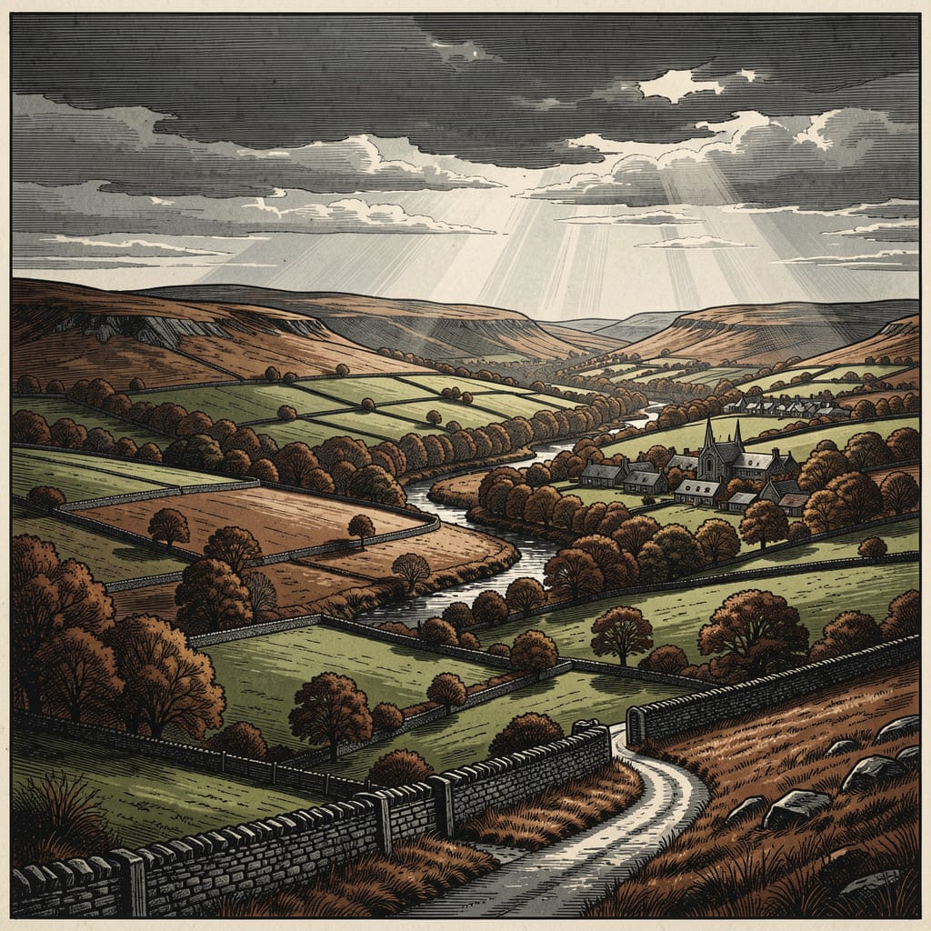
Derbyshire is the principal county setting of the entire Book of Thoth Saga, named in the very first text of the novel: a single italicised line at the head of Chapter One: QuietDerbyshire, 1995. No other geographical orientation is offered. The county is treated as sufficient. The fictional village of Hope's End sits within its real geography without being assigned a precise grid reference.

The Knight relocation. A Beowulf-archive note recovered by Declan Marsden records the post-1987 fact baldly: Knight brothers relocated to Hope's End, Derbyshire. 200+ miles inland from Shoreham. Why? Hiding? Or containment? The choice of Derbyshire, on the available reading, was deliberate: a county where settlements are small, weather routinely difficult, and a child of no recorded existence could grow up in a small Peak District village without drawing the attention of the agencies that had attempted to ensure he was never born. The question raised in Declan's note — hiding or containment? — recurs across the saga.

The Mammon coin pattern. In the six-week period following Robert Knight's manifestation event of November 1995, an anomalous one-pound coin surfaces at five Derbyshire and South Yorkshire towns — Derby, Matlock, Bakewell, Chesterfield and Sheffield — all within forty miles of Hope's End, in a geographical pattern that Declan identifies as inward-tightening on the village. The coins all share the same mint mark, weigh three times what a sterling pound coin should weigh, and remain warm to the touch even in December. Canon establishes that the Bakewell coin appeared before the Matlock coin; the full chronological sequence of the other three is not given in the text. Declan's account of the mechanism is precise:

Vice spreading across Derbyshire like rot through timber. Cambion, Chapter Thirteen.

Months later, in Chapter Eighteen: Creep, the kitchen radio relays three local news items in a single newsreader's sentence: a warehouse fire outside Chesterfield, a vicar in Matlock describing ‘mindless vandalism’ after someone has torched the church porch, and a Derby accountant ‘helping police with enquiries’ over missing funds. Three discrete acts of arson, vandalism and embezzlement — three classifications of vice — falling cleanly across three of the five Mammon-pattern towns. The text does not connect them aloud. The geography rhymes in the background.

Beowulf and Orion operational territory. The county functions as an active operational zone for the two principal covert agencies in the saga. Ben Knight's base of operation is formally recorded in Beowulf documentation as Hope's End, Derbyshire, UK. The laminated OS maps of the Dark Peak pinned above the fire in his room, edges curling, indicate his relationship with the country: he knows it as terrain, not as scenery. Orion's return to Derbyshire — confirmed during a charged exchange between Amy and Declan Marsden — signals an escalation. Field operatives are inbound. Through the late chapters, the county is increasingly the site of competing surveillance operations to which the inhabitants of its villages and towns are not party.

Cultural texture. The county is present in Cambion as much through its texture as through its events. The Derbyshire Times sits on Toby's kitchen table with the crossword half-done. A faded Derbyshire cricket pennant hangs in his room. Ben's rejoinder to Robert's complaint about the cold — It's December. In Derbyshire. What did you reckon it'd be? — carries the flat, unimpressed logic of someone who grew up in the place. The dialect word nesh, used by Ben and (separately) by Mick Hargreaves at The Rail and Reservoir, places the speakers as people of a specific country, speaking as people of that country speak. None of these details comments on the supernatural events surrounding them; they exist to confirm that the world goes on, and that the county has not, on its own account, noticed it is at the centre of anything.

The reddish soil. Among the saga's smaller and more telling details: in Chapter Forty-One, Robert, going through Ben's wardrobe, finds work boots heavy with reddish soil — the wrong colour for Derbyshire, which is limestone country with grey, brown and ochre soils. The county's own geology, recognised without being analysed, registers as an early warning that Ben has been somewhere he has not accounted for.

Daniel's map. In the closing pages, Daniel Marsden, working a wall map at international scale, draws a single line from a red pin in Sydney across the page, across the ocean, until the ink bleeds over Derbyshire: a tiny rain-drowned point in a country that has no idea what is coming. He writes on the map, beside the line: When two fires meet, they do not cancel. They feed each other. They build. The county, at that scale, is barely visible. That the entire saga has unfolded within that barely-visible point is the most economical observation the page makes about the relationship between the ordinary and the catastrophic.


Quotes from the Saga

  • “It's December. In Derbyshire. What did you reckon it'd be?”

    Ben Knight, Cambion, Chapter Eleven.
  • “The ordinary smell of an ordinary Derbyshire night, indifferent to all of it.”

    Cambion, Chapter Forty-Eight.
  • “Late summer lay across the Derbyshire hills like silk sliding from a shoulder.”

    Cambion, Chapter Fifty.
  • “The long, grey hush of a Derbyshire winter.”

    Cambion, Chapter Fifty-One.

Trivia

  • The Peak District National Park, designated on 17 April 1951, was the first National Park created in the United Kingdom under the National Parks and Access to the Countryside Act 1949. The decision to give the Peak the inaugural designation followed the 1932 Mass Trespass on Kinder Scout, which is generally regarded as the catalyst for the post-war national-park movement.
  • In 2003 the Ordnance Survey identified Church Flatts Farm at Coton in the Elms, just inside Derbyshire's southern border, as the geographical point in Great Britain furthest from any coast. It is approximately seventy miles from the nearest sea (the Wash, the Mersey or the Bristol Channel), depending on direction taken.
  • Derbyshire is one of the few English counties that retains a continuous tradition of well dressing — the dressing of village wells with elaborate flower-petal panels — in summer through the spring and summer months. The custom is generally held to descend from pre-Christian thanksgiving for fresh water; modern revivals date from the late eighteenth century. Tissington holds its dressings on Ascension Day and Eyam in August; some twenty-odd other villages have their own dates.
  • The Derbyshire Times, the county's longest-running newspaper, was founded in 1854 and has been published continuously since. The 1995 issues that appear in the saga would have been printed at the paper's long-time works in Chesterfield.
  • The Derbyshire dialect retains a number of words traceable to the Anglian and Old Norse settlement periods that have largely disappeared elsewhere in standard English: nesh (sensitive to cold; from Old English hnesce), mardy (sulky), mithered (troubled), and the address-form duck (an unrelated dialect word, used to most members of the public in many parts of the county).
  • Eyam, in the limestone country a few miles north-east of Bakewell, is one of the more remarkable villages in England. In 1665, on the arrival of bubonic plague carried in a bolt of cloth from London, the village rector William Mompesson and his Puritan colleague Thomas Stanley persuaded the entire population to quarantine itself voluntarily for the duration of the outbreak, accepting their food and supplies left at the village boundary. By the time the plague had run its course in 1666, more than two hundred and fifty of the village's eight hundred residents had died. The neighbouring villages had been spared.
  • Derbyshire County Cricket Club, founded on 4 November 1870, is one of the eighteen first-class counties of English cricket. Its principal home ground is the County Cricket Ground in Derby; second venues include Queen's Park in Chesterfield.

Appearances

Title Role Notes
Cambion
Book One · Book of Thoth Saga
Primary County Setting Named in the opening line of Chapter One: QuietDerbyshire, 1995. Present throughout the novel as weather, landscape, sensory texture, and the operational territory of both human and supernatural agents.
Beauty and the Beast Within
Book Two · Book of Thoth Saga
Primary County Setting Details forthcoming.
Hope's End
Book Four · Book of Thoth Saga
Primary County Setting Details forthcoming.