Chesterfield

Chesterfield, Derbyshire — the Crooked Spire town on the eastern edge of the county

Location Profile
Type Market town and civil parish
Borough Chesterfield
County Derbyshire, England
Rivers Rother and Hipper
Population 103,569 (2021 census, borough)
Postcode S40–S44
Founded Roman fort, c. AD 70 (Cestrefeld, Old English ‘fort field’)
Market Charter 1204 (King John)
Notable Building Church of St Mary and All Saints (the Crooked Spire), Grade I listed
First Appearance Cambion, Chapter Thirteen: The Coin That Never Spent

Chesterfield

Market town in north-east Derbyshire; the Crooked Spire town.


Overview

Chesterfield is a market town and civil parish in north-east Derbyshire, England. It is the largest settlement in the county after Derby, with a borough population recorded at 103,569 in the 2021 census, and lies some twenty-four miles north of Derby on the eastern slope of the Pennines, where the limestone uplands of the Peak District give way to the lowland coalfields of the Midlands fringe.

The town is best known internationally for the Crooked Spire of its medieval parish church — the lead-clad fourteenth-century timber spire of the Church of St Mary and All Saints, which twists approximately forty-five degrees and leans some two and a nine-tenths metres (nine feet six inches) from the vertical. The spire has been the town's defining landmark and de facto civic logo for over six centuries. Chesterfield was granted its market charter by King John in 1204; an open-air market is still held in the medieval market place to the present day, twice weekly.


Geography & Atmosphere

The town occupies a south-facing slope of high ground between the Rivers Rother and Hipper, where the Pennine uplands taper into the rolling country of north-east Derbyshire. The medieval town centre, on the higher part of the ridge, is built around the parish church and the cobbled market place; older streets — Saltergate, Knifesmithgate, Packers Row, the narrow alleys collectively known as the Shambles — preserve the contour-following lines of the medieval burgage plots. From the Market Place the ground falls away westwards toward the Rother valley.

Chesterfield's atmosphere is industrial and direct in a way the spa towns of the western Peak are not. The town's nineteenth- and twentieth-century prosperity was built on coal, iron and railway engineering. The collieries are now mostly gone — Markham, the last deep pit in the immediate area, closed in 1993, and the surrounding Derbyshire coalfield ceased deep mining altogether within a year — but their legacy is still very legible in the surrounding landscape: reclaimed spoil heaps re-greened into low hills, terraced colliery streets along the valley roads, and Miners' Welfare clubs and Methodist chapels persisting in the former mining villages around the town. Above all of it, on the ridge, the spire visible from every direction of approach.

History

The site of Chesterfield was first occupied as a Roman fort, established around AD 70 on the Roman road north from Derventio (Derby). The Old English place-name Cestrefeld, ‘fort field’, preserves the memory of that fortification. A Saxon and then Norman settlement followed at or near the same site; by the twelfth century there is evidence of an organised market, and on 9 May 1204 King John granted the borough its market charter, allowing the holding of a weekly market and an annual fair. The medieval town was relayed out at this point, drawing the centre of gravity slightly westward of its earlier core around the parish church.

Construction of the present Church of St Mary and All Saints, the largest parish church in Derbyshire, was begun in the late thirteenth century and substantially completed by around 1360, in a mixture of Early English, Decorated and Perpendicular Gothic. The wooden lead-clad spire was added some years later, almost certainly after the Black Death of 1349, and quickly began to twist on its frame in a way that has continued, slowly and unstoppably, ever since.

The medieval and early modern town developed steadily around the market and the cloth trade. Revolution House, a small thatched seventeenth-century alehouse (formerly the Cock and Pynot) at Old Whittington on the northern edge of the town, was the meeting place in 1688 at which three local Whig nobles — William Cavendish, fourth Earl of Devonshire (later first Duke of Devonshire of Chatsworth), Thomas Osborne, Earl of Danby, and John D'Arcy — conferred on the invitation to William of Orange that became the Glorious Revolution. The cottage is preserved by Chesterfield Borough Council and operates as an occasional museum.

Chesterfield's industrial transformation came with the railway. George Stephenson, the engineer of the Stockton and Darlington and Liverpool and Manchester Railways, settled in Chesterfield in 1838 to oversee construction of the North Midland Railway, which ran south from Leeds to Derby through the town. During the cutting of the Clay Cross tunnel south of Chesterfield, a substantial seam of coal was discovered; Stephenson founded the Clay Cross Company to work the seam, and lived at Tapton House on the eastern edge of the town until his death in 1848. He is buried at Trinity Church on the Newbold Road.

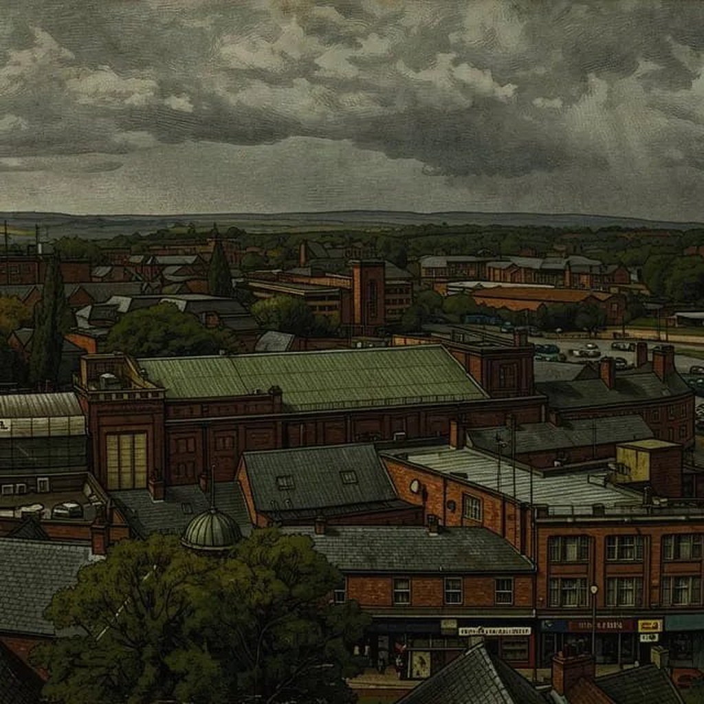
The discovery of the coalfield, and the railway running directly through it, transformed Chesterfield through the second half of the nineteenth century into a centre of mining, iron-founding and heavy engineering. By 1900 a ring of collieries surrounded the town — Markham, Bolsover, Glapwell, Clay Cross, Williamthorpe, Pleasley, Whitwell — supplying coal to the railway, the local ironworks, and the wider national grid. The town's growth in this period followed the contours of the coalfield: the terraced colliery villages along the valley roads, the Miners' Welfare clubs, the Methodist chapels, the Co-operative stores. The economic and social character of north-east Derbyshire was, for nearly a century, the character of a coalfield.

The dismantling of that economy in the late twentieth century was abrupt. The 1984–85 miners' strike, which was prosecuted with particular intensity in Derbyshire, was followed by a programme of pit closures over the next decade that ended local deep coal mining altogether. By the time the events of Cambion open in 1995, the last Derbyshire deep mine has closed within the previous twelve months; the social and economic dislocation that followed the closures is still recent, and the colliery villages have not yet found a new economic basis to replace the one that has been taken from them.


The Crooked Spire

The spire of the Church of St Mary and All Saints rises to two hundred and twenty-eight feet above the ridge of high ground at the centre of the town. It is octagonal in plan, of timber framing covered with lead, and from its base it twists — visibly, dramatically, in a way no straight observation can entirely accommodate — through approximately forty-five degrees in a clockwise spiral, leaning some two and nine-tenths metres (nine feet six inches) from the vertical at its tip. It is, by some considerable margin, the most strikingly distorted church spire in Britain, and one of the most photographed.

The structural cause is reasonably well understood. The medieval builders used timber that was insufficiently seasoned — green oak, which then dried unevenly under the load of the roughly thirty-two tonnes of lead tiles which clad the structure. The cross-bracing was inadequate to compensate for the asymmetric drying of the timbers under that load. The lead, expanding under solar heating on the south face and contracting on the cool north face through every diurnal cycle for the first several centuries of the spire's life, took the warping further. By the time anyone understood that the spire was no longer simply settling but undergoing a continuous structural process, the process had committed and could not be undone.

Folklore, in this case, prefers a more interesting account. One tradition holds that the devil, perching on the spire to rest mid-flight, was so startled by the smell of incense rising from the church beneath him that he twisted in the air and gave the spire its kink. Another account, cited locally with appropriate civic gravity, holds that a virgin came to the church to be married, and the spire, astonished beyond all credit, bent down to look. Neither account has any historical substance. They are nonetheless good stories, and a town with a six-hundred-year-old visibly impossible church spire is allowed its better stories.

A fire on 22 December 1961 broke out in the north transept and threatened the entire structure for two hours before being brought under control. The spire survived. The cost of the damage was around £30,000 and was made good within a few years. The Crooked Spire continues to lean, in essentially the same posture it has held for six centuries, over the market place beneath it.


Markets, Industry & Heritage

The Chesterfield Market — held in the cobbled market place at the centre of the town since the borough charter of 1204 — is one of the largest open-air markets in England and has run, in some form, for more than eight centuries. The Victorian Market Hall (1857) anchors the western side of the square. The covered Shambles, narrow medieval alleys lined with butchers' and small traders' premises, run off the south side and preserve the burgage-plot layout of the medieval borough.

The town's industrial heritage is unusually intact for a place that has lost almost all of its primary industries. Tapton House, George Stephenson's residence, survives as a public park; Revolution House at Old Whittington is a small museum; the Chesterfield Canal, built between 1771 and 1777 by James Brindley and others to carry coal and lead to the Trent, has been progressively restored from the late twentieth century onwards as a recreational waterway. The town's former Co-operative buildings, Miners' Institutes, and railway-engineering works survive in considerable numbers, in various states of repurposing.

Queen's Park, on the south side of the town, has hosted Derbyshire County Cricket Club fixtures since 1898; both W. G. Grace (in 1904) and Don Bradman (in the 1930s) played cricket there. The park is generally regarded as one of the more attractive county-cricket grounds in England.


Role in the Saga — Cambion spoilers Contains plot reveals from Book One.

Chesterfield is one of the five Derbyshire and South Yorkshire towns at which an anomalous one-pound coin appears in the six-week period following Robert Knight's manifestation event of November 1995. Tracing the coins from the example recovered at The Rail and Reservoir, Declan Marsden identifies the five locations as Derby, Matlock, Bakewell, Chesterfield and Sheffield — all within forty miles of Hope's End, in a geographical distribution that forms an inward-tightening pattern around the village. Chesterfield, on the eastern edge of the cluster nearest Sheffield, sits where the pattern reaches its furthest north-eastern extent.

The coins themselves are physically distinctive. Each carries the same mint mark, weighs three times what a sterling pound coin should weigh, and remains warm to the touch in any temperature. They are not in normal circulation; they are planted by hand by the same unidentified woman, who pays for a small purchase with the coin in each town and leaves. Declan's identification of the pattern, in Chapter Thirteen: The Coin That Never Spent, is grounded in his Beowulf-archive knowledge of similar coins surfacing in the margins of historical clusters of supernatural disturbance:

Same mint mark. Same weight—three times what sterling should be. Same warmth, even in December. And wherever it's been, people start seeing things they want. Things they'd kill for. That's how Mammon works—not by taking, but by making you reach. Declan Marsden, Cambion, Chapter Thirteen.

The geography is, on Declan's reading, deliberate. Chesterfield's significance to the pattern is structural: it is the largest urban centre in Derbyshire outside Derby, with one of the largest open-air markets in England, conducted on a cobbled square that has been hosting the unconsidered hand-to-hand passage of cash for more than eight centuries. Whatever warmth the wrong pound carries, it can pass through several thousand pairs of hands on a Saturday morning here without anyone examining it.

Subsequent radio mention. Months later, in Chapter Eighteen: Creep, the kitchen radio at 13 Haversage Road relays three local news items in a single newsreader's sentence: a warehouse fire outside Chesterfield; a vicar in Matlock describing ‘mindless vandalism’ after someone has torched the church porch; and a Derby accountant ‘helping police with enquiries’ over missing funds. The three news items are local-radio routine; they are also three discrete acts of arson, vandalism and embezzlement — three classifications of vice — falling cleanly across three of the five Mammon-pattern towns. The text does not connect them aloud. Robert, then waiting for a song, lets the words slide past him. The geography rhymes in the background, audibly enough for any listener to notice if they are listening.


Trivia

  • The Crooked Spire is octagonal in section; each of its eight faces twists at a slightly different rate around the central axis, giving the spire its characteristic spiral. Photographs taken from different points around the church show subtly different leans, because no two viewing angles see the spire's axis identically.
  • Chesterfield's last operating colliery, Markham, closed in 1993. The wider Derbyshire coalfield closed completely within the following year. The aftermath of the closures — in particular the collapse of pit-village economies and the patchy uptake of regeneration funding through the second half of the 1990s — is a defining feature of the town's social landscape during the period in which Cambion is set.
  • George Stephenson, the railway engineer, is buried in Holy Trinity Church on Newbold Road. A statue of him erected outside Chesterfield railway station in 2006 commemorates his association with the town.
  • Revolution House at Old Whittington, the small thatched alehouse where the Glorious Revolution of 1688 was effectively planned over a hunting party's drinks driven indoors by rain, has, by the standards of Whig-political pilgrimage sites, an extremely modest visitor centre. The conspirators — the fourth Earl of Devonshire (then living at Chatsworth), the Earl of Danby and John D'Arcy — appear to have ridden onto Whittington Moor for the meeting and only retreated to the inn when the weather turned.
  • Chesterfield Football Club, founded in 1867, is one of the oldest professional football clubs in England. The club moved from its long-time home at Saltergate in 2010 to a new ground on the northern edge of the town.
  • The Chesterfield Canal, completed in 1777, was a Brindley project that runs forty-six miles north-east from the town to the River Trent at West Stockwith in Nottinghamshire. The Derbyshire end has been progressively restored as a navigable waterway since the 1990s.

Appearances

Title Role Notes
Cambion
Book One · Book of Thoth Saga
Referenced; Mammon Pattern Location One of the five towns named in Declan Marsden's account of the anomalous-coin pattern in Chapter Thirteen: The Coin That Never Spent. Mentioned again in Chapter Eighteen: Creep, in a kitchen-radio news bulletin relaying a warehouse fire outside the town. Chesterfield never appears as a directly-set scene.